City walks list many walks, trek, hike available near you in order to breath after this quarantine time.
Story behind this project
For this month, I’ve wanted to make an app related to the current situation we live in the world. In France where I’m living, we approach the end of the quarantine but not the end oh the restrictions. For the first weeks post quarantine, we couldn’t move far than 100 kilometers away from our home.
After the quarantine, a lot of people wanted to go outside and enjoy nature, all the more for city dwellers who lives in small flat and can’t have a garden.
So I’ve wanted to make an application that lists walks and hikes available in a nearby radius.
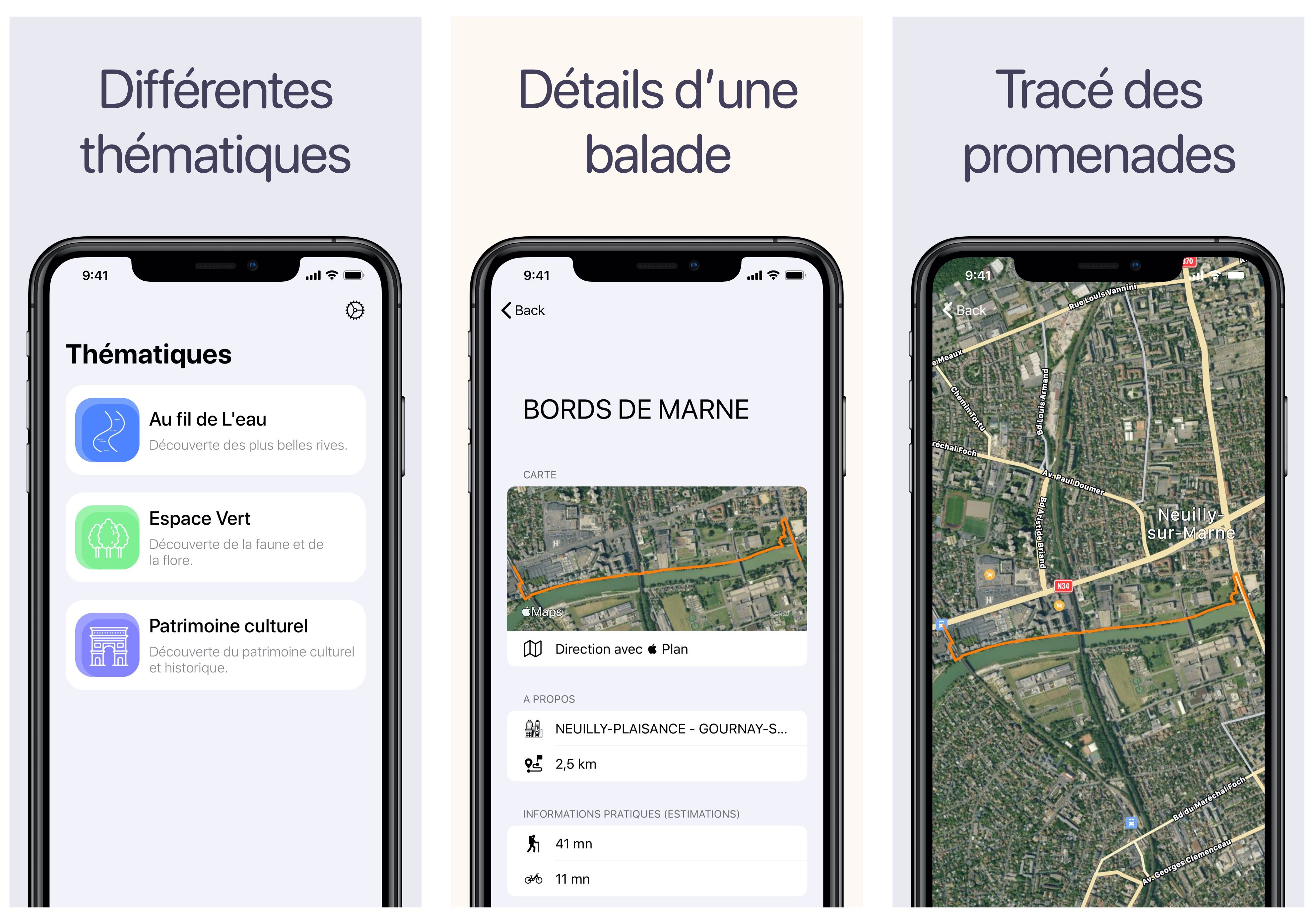
I’ve started to look at data.gouv.fr, there is a lot of open data available. After a quick search, I found that some region share their PDIPR (Departemental plan for walking and hiking routes). In this dataset I managed to find walking routes with their geopath and a small description. This was exactly what I needed.
Regarding the app, the core features are really simple and was made quick. I took a bit of extra time to work on animations and transitions between each views.
For the first version of the app, I only work with a single dataset. It was more than enough to test the feature I’ve wanted. When the app was ready, I looked on data.gouv.fr for similar dataset from other regions. After few hours of searching, I can’t find any dataset similar to the one I use. They didn’t follow any kind of convention when making their dataset.
I’ve submited the app at the end of may, few days later the app was rejected because they found it kind of useless.
Next steps
I will try to make a course about iOS development and will use this application as the project for the course.